Man and the island
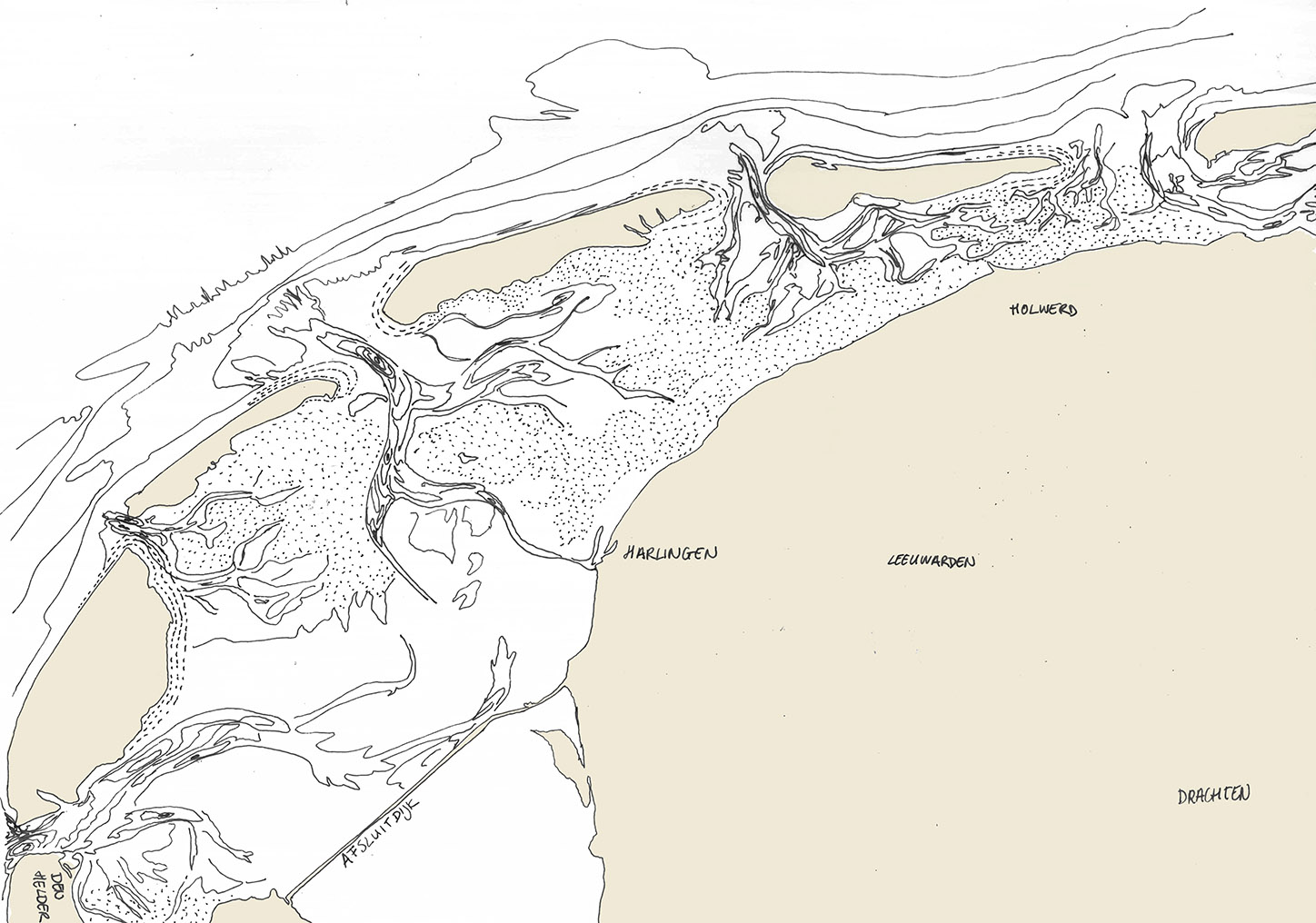
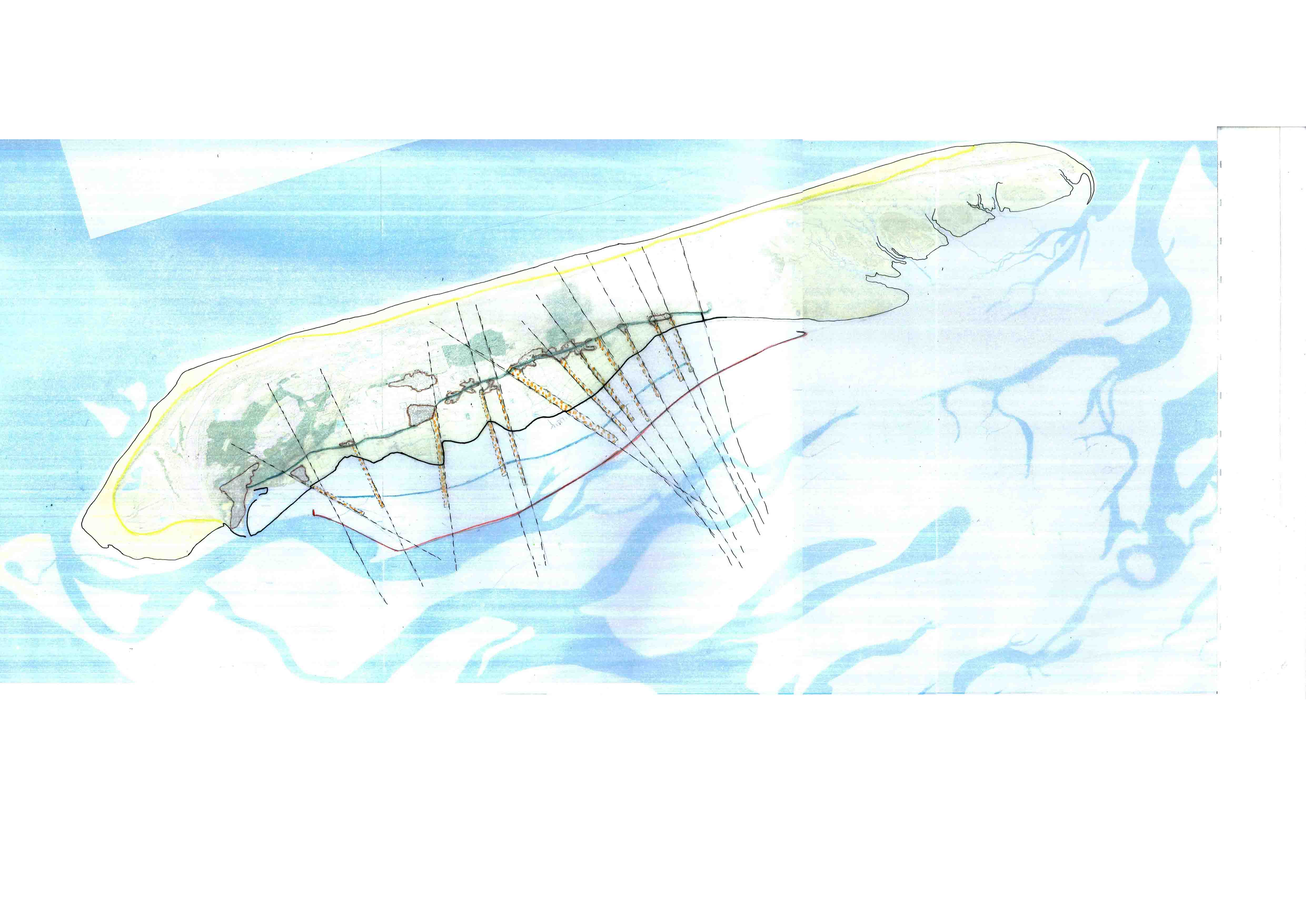
Human occupation on the Wadden islands has always been a struggle against the elements. Because the islands are formed mostly from sand deposited over millennia by the rising North Sea and the rivers IJssel, Eems, Wesel and Elbe, the shape of the islands was not fixed. The western wind blows the sand from the beaches and dunes towards the east. At the same time tidal forces and the flow of rivers had an impact on the movement of the islands. In the last decades however, because of the closing off of the IJsselmeer (the outlet of the river IJssel), these patterns of sedimentation have changed. A possible future scenario is the silting up of parts of the Wadden Sea.
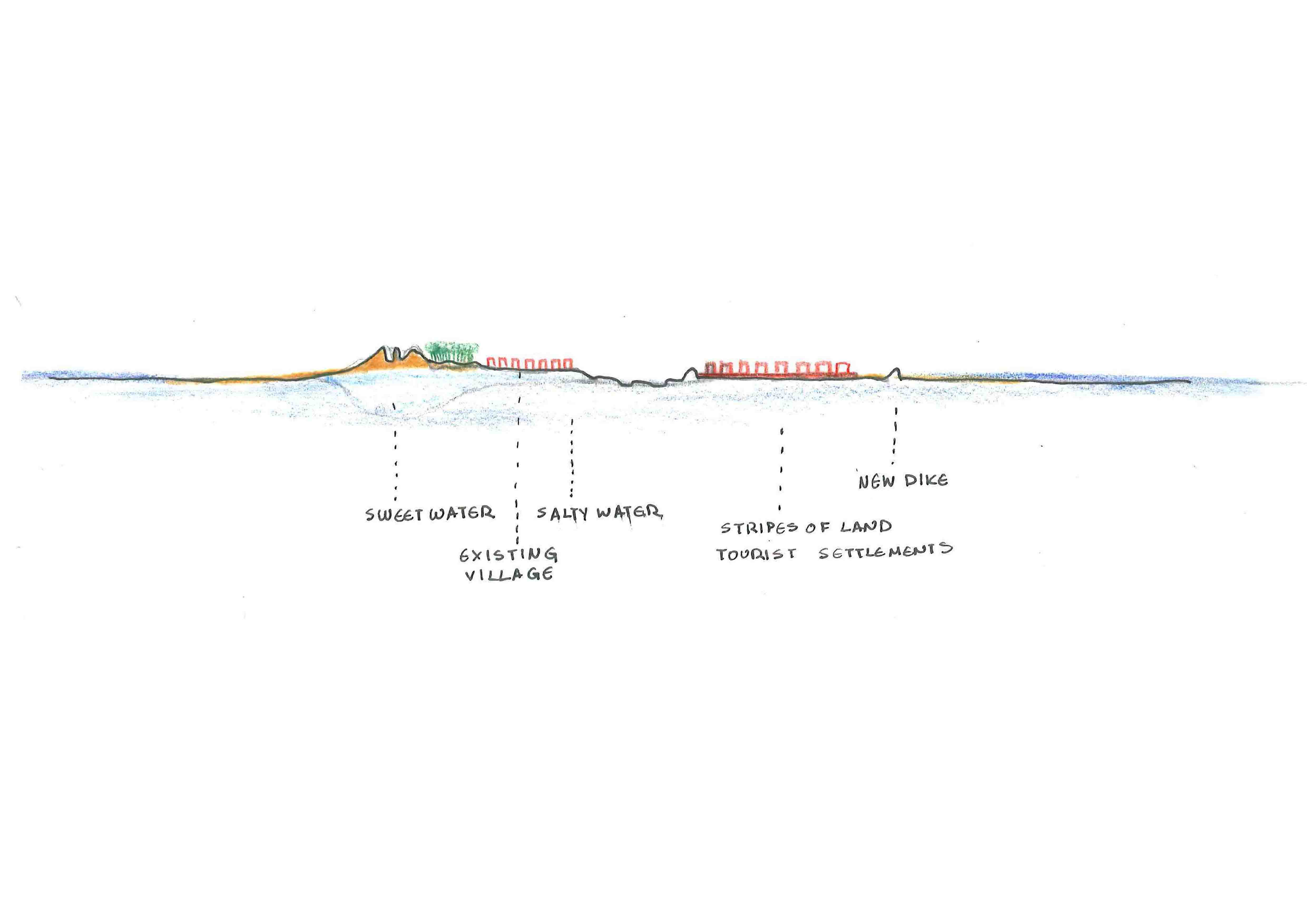
During the early middle ages lower parts of the islands were prone to flooding. As a result the first settlements (mainly farms operated by monks) were constructed on overgrown higher ground and on artificial mounds (terps). During the middle ages, several dikes were constructed to the south of the villages. In the following centuries these dikes proved insufficient to keep the whole area dry. Some settlements had to be abandoned, and in 1602 the Strieperdijk was constructed as a more solid defence barrier. After the flood of 1825 an even stronger sea dyke was constructed.
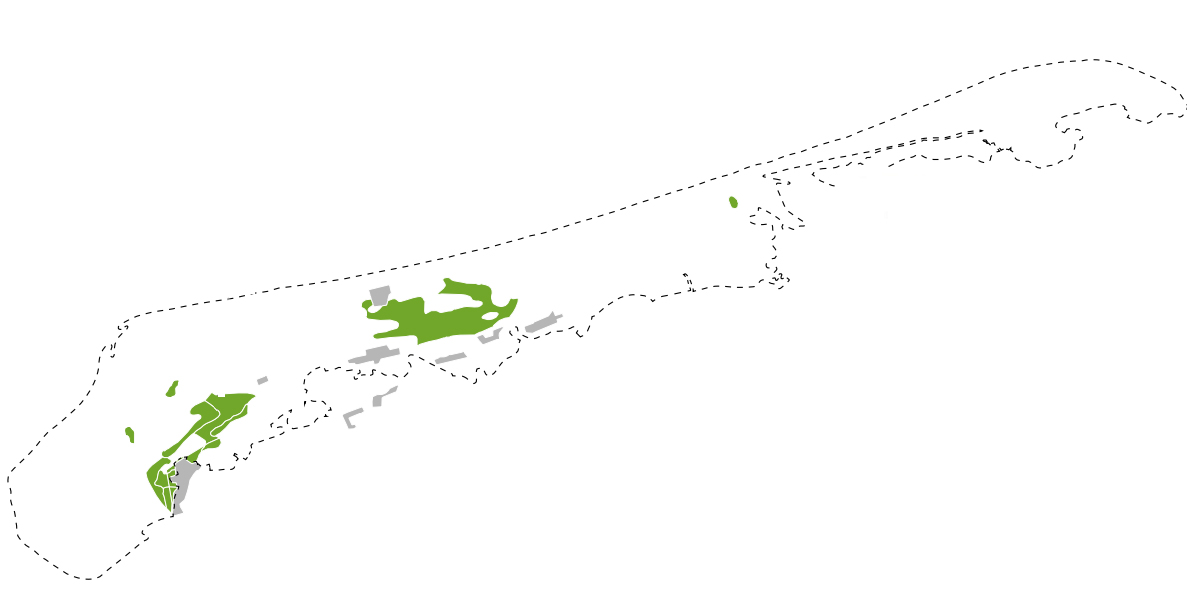
At the northern side of the island the dunes remained free to accumulate over the centuries, and to move in a dynamic way. To stop the dunes from encroaching on the villages in the polder to the southeast, the sand was fixated in the early 20th century by planting pine trees on a thin layer of peat that was imported from the mainland. The trees are spread wide apart, because their roots are superficial. During a storm many topple. The artificial stabilisation of the dunes could possibly lead to an unstable slope on the polder side. Lately,to the northwest of the polder trees have been removed to let the dunes move more naturally.
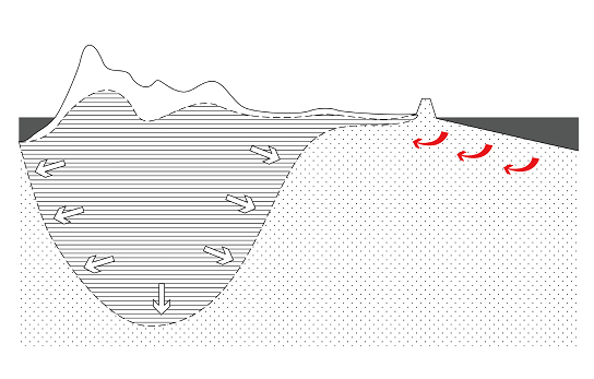
To keep the polder dry at all times, precious water has to be pumped into the sea. By pumping out polder water, the fresh water reserve under the island is shrinking. Due to the depth of the fields in the polder along the sea dyke, in relation to the seawater level, there are already some places where the soil is turning saline. Rising seawater levels could mean that without some kind of interference, the polder will eventually become too salty for dairy farming and in the end even flood.
This can be prevented by several interventions. One of them is to speed up sedimentation. This is done by wooden poles placed at certain locations just outside the island. In this way new land is created for marine birds outside of the current island. This way the salt water pressure is diminished.
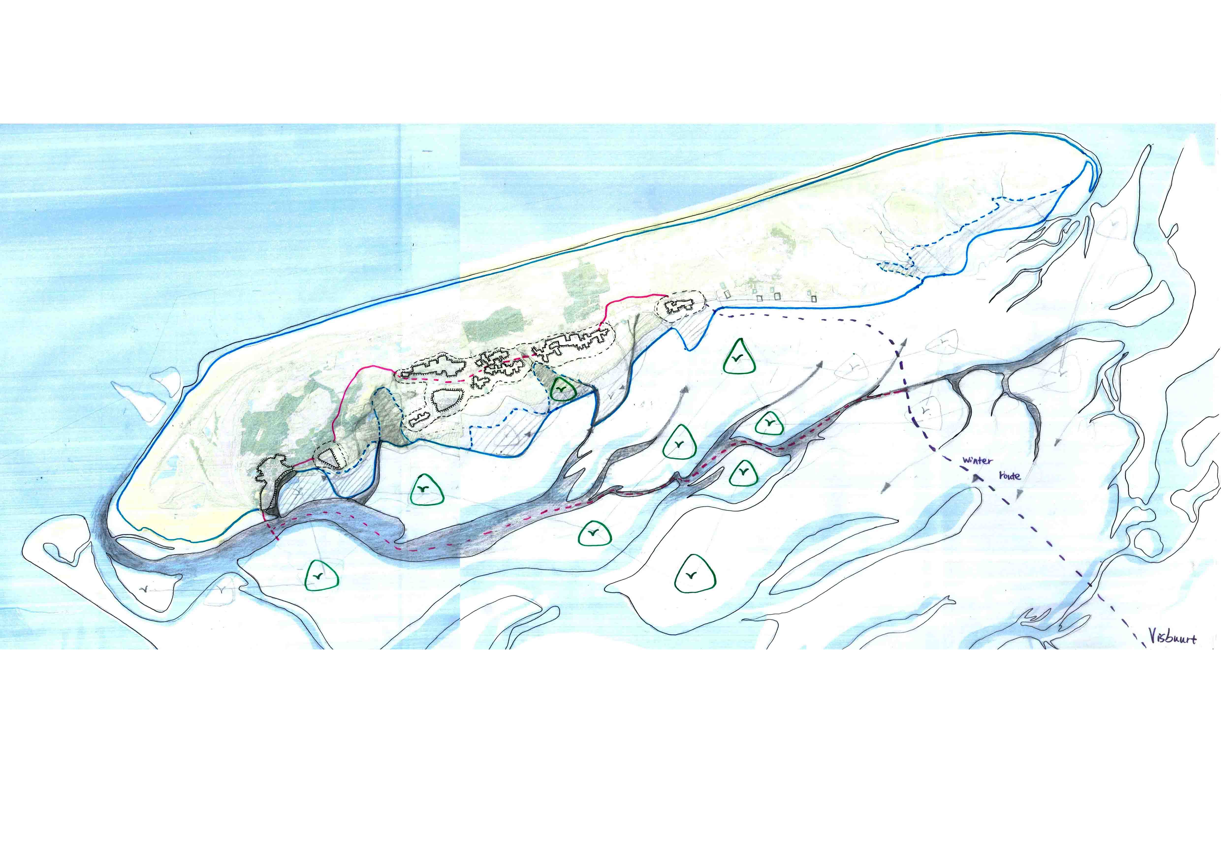
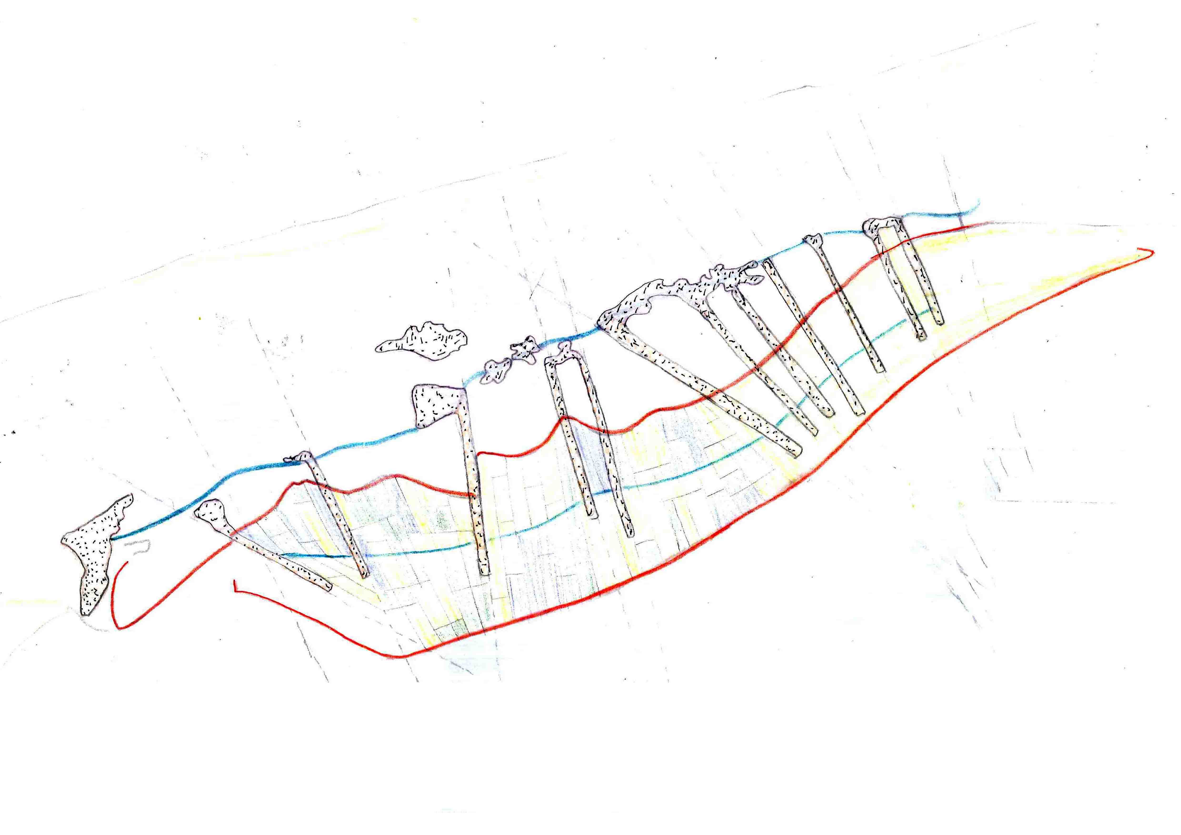
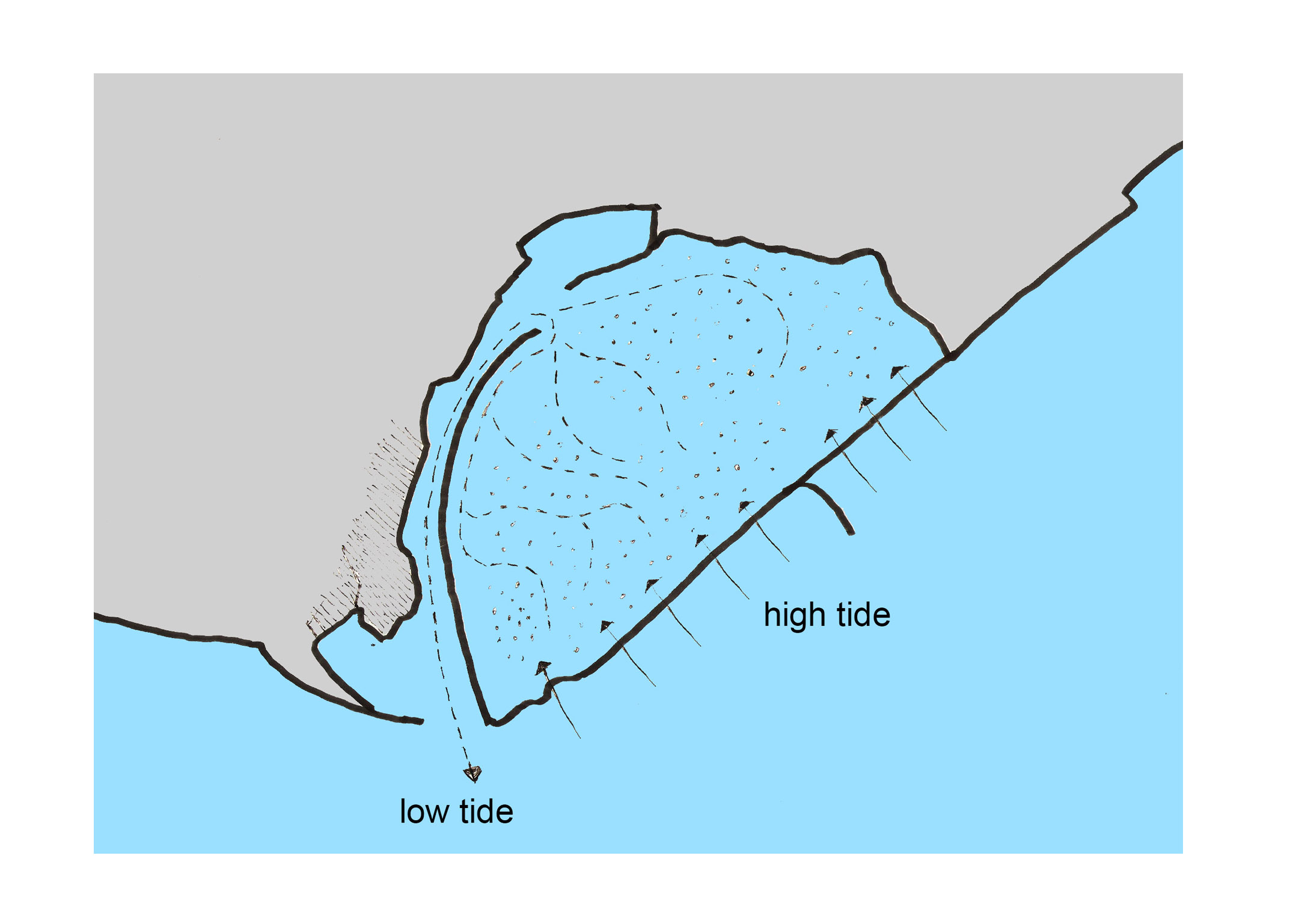
The harbour of the island is kept at depth by an artificial current that is induced by a small breakwater to the southeast of the harbour. During high tide, water flows over the breakwater. During low tide it can only leave through a narrow gully at the harbour entrance, taking out sediment.
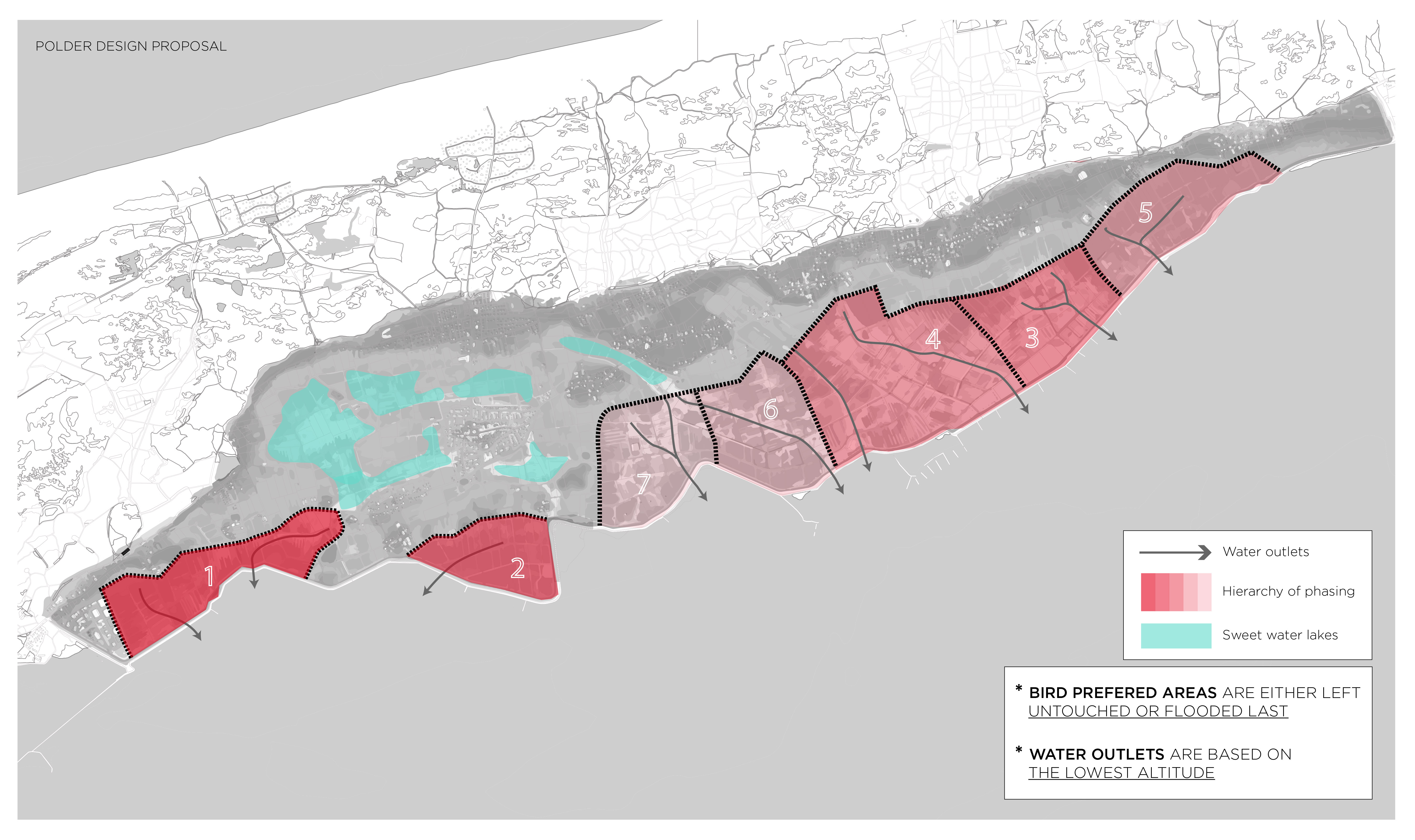
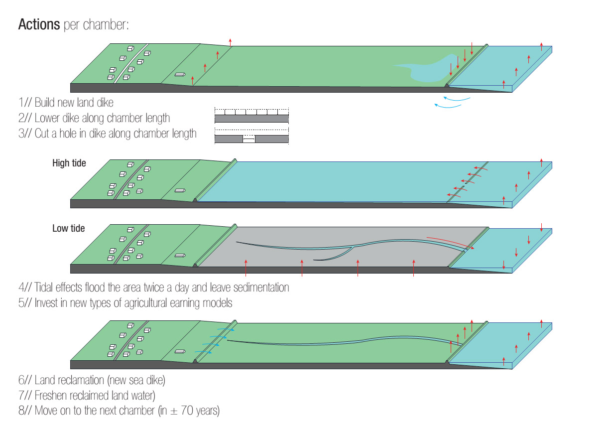
A controversial solution to maintain the polder for farmers as well as birds could be to use a similar construction in uninhabited sections. By letting the seawater into such a chamber at high tide, new sediment accumulates in the polders that are currently below seawater level. In some decades the problem of salt-water pressure on the agrarian land could be resolved.